Day 4 – Epic Solo Bike Ride

Oh my gosh!  My legs are so sore!  I don’t want to get out of this bed.  But setting a quick alarm for 6:30 anyway.  Its now 5:20.

One thing I’ve decided upon is this. 50 miles per day on a fully loaded bicycle camping trip is a little too much. Its fine when you’re supported and don’t have to carry all your stuff. But 50 miles, three days in a row is just a bit much. Last night I was pleased to find that I could grab the bus a few miles early. And if I switch just right, I can get a ride all the way to my campground. A total of only 35 miles. I’m going to do that today. Probably save myself a good 15 miles from the original plan.

Skipped my plan for coffee, and hit the road at 7am. Apparently I was rested enough and I couldn’t sleep anymore. Reached Raymond where I ran into this guy.

image

The stretch of 105 between Raymond and Grayland is easily the most magnificent part of my ride so far. Nice pavement, with huge safe shoulders to ride on. The sun was shining most of the way there.

image

image

Today, on this beautiful stretch of road, I caught up to Shane and his cat Funtime who was riding in the trailer behind him.
image

Shane is the first touring cyclist I’ve encountered on my trip so far. And he is notorious. He is banned from posting on crazyguyonabike.com, because apparently it is too controversial to take your cat on your bike touring trips. Shane is on his 18th month of cycling and has run out of money more than 6 months ago.

Quick sum up here. Bus to Aberdeen, lunch at Ann Marie’s cafe with this view from my seat. Just got in before they turned off the grill.

image

Then a quick bus ride up to Pacific Beach Park, only a few blocks from my camp site. It’s now cold, windy, and overcast. Today’s GPS map doesn’t show my current location as I’ve bussed several miles to the north. But here’s the path.

image

Detailed GPS map is available here.

Tomorrow marks the beginning of what I thought was going to be the real adventure of this bike trip. That was before day 2 happened. :-). Now I’m not so worried about the anticipated gravel tomorrow, cause I know it’s there. And I’ve got the recent experience to know that I can handle it just fine. And I’ve saved some energy by reducing my miles today. I’m totally ready for it.

Still. I need extra water, and from here on out there are no more big cities. My only options for food I think will be little markets with few choices. I’ll need to put a lot of thought into what I pack as I will be hitting the Pacific Northwest trailhead on Wednesday. I’ll need supplies, including water to last for a couple days. Now why did I think my camelback was not necessary? Just one more little cock-up my friends on this grand adventure. And I have time and options to deal with the difficulty.

I may be out of reception tomorrow. But I think it is inevitable on Wednesday and Thursday that there will be no reception. I’ll try and check in when I reach the Hoh River on the 6th. But don’t be surprised if you see nothing from me again until the 8th or 9th.

Posted in Pictures, Routes | 1 Comment

Day 3 – Epic Solo Bike Ride

Choosing between rewriting yesterdays lost post, or doing nothing.  My butt is aching, as is much of my body.  I had spent an hour writing a post for day 2, and the WordPress App lost it when I backed out. Slightly disappointing. I’m tired, but it’s difficult to sleep.  I want to get an early start so I’m not pitching my tent at 9pm again tonight.

Last night, as I finally got my tent up and hit the single shower at roughly 9:30, I found that it cost $0.50 for a shower. The cost was no big deal, but getting quarters was a problem. I ended up having to purchase two soda’s from the machine next door which were $0.75 so that I could get two quarters back. And then I was fearful the thing was going to shut off on me. I didn’t see any obvious indication of how long I got, so I was finishing through cleaning up and didn’t do a great job. It was a less than satisfying end to a rough day.

So as I set out for today’s ride at 8am, this was weighing on my mind. I had knew that day three’s campground likely didn’t have a shower and I was pondering riding a few miles to some South Bend to shower, then riding back to Bruceport. But there was still no guarantee of a shower this way.

image

At about mile 20, I came across this place where I decided to fill my water bottles. And then I realized I could eat here too. Soo glad I stopped. Big portions and yummy food. It is the first time since leaving Portland that I’ve actually felt like I had enough to eat.

image

While I’m sitting there waiting for this bounty, I have a look at the map of South Bend, and with curiosity, I type in “hotel”. And up pops a nice little place with a 4.5 star customer rating. And before I realize it, I’m on the phone making a reservation for tonight. They have a shower, and WiFi. Oh I’m so looking forward to a night in a hotel now.

image

But, before I get there, google navigator has me taking another slight detour. And it’s not for a couple miles before I hit gravel again. Its a beautiful ride, and I’m running early today. And I know I’ve got a shower and hotel waiting on the other side. So this 6 miles of deserted gravel road is entirely enjoyable.

image

Most of it looks exactly like the picture above. There was a running stream off to the right for much of it.

When I arrive at the hotel at about 4:30, I’m a little disappointed to hear that the there is not bike shop or laundry mat in this small town. I would need to hit the next town up (Raymond) for any of those services. But the lady behind the counter offers to do my laundry for me if I just leave the bag a outside my room door. OH MY GOSH! 5 STAR’s on yelp for the Seaquest Motel in South Bend. The motel is really nice. They pay attention to all the little details. There’s a fridge and a little kitchen area. It feels like a home, and not a cheap motel room. Total recommend it if you’re ever here.

Too tired for any more pictures. I eat a burger at the local restaurant, again where they don’t serve fries. But the side salad is really yummy. A quick investigation reveals that I won’t be leaving until 8am tomorrow. Cause that’s when the coffee shop opens, as well as the local shopping mart.

Finished Day 2’s post and went off to bed.

image

For a link to the full GPS map, click here.

Posted in Pictures, Routes | 4 Comments

Day 2 – Epic Solo Bike Ride

A moment of silence for James Kim please.  I was reminded of him more than once today.  The original story was that he was directed to take a road by his navigation software that got his vehicle stuck in the snow.  He died trying to walk out for help while his family stayed behind.
http://en.m.wikipedia.org/wiki/James_Kim

You’ll understand why I thought of him as you read on.

Now, on to today’s ride blog.

One of the best things about riding solo is that you’re not constantly wondering if you’ll be left behind by the group.  Waking up for day two of my ride was one of the most relaxed times I’ve ever had packing up camp and starting the ride.  I didn’t get started until 10am.

image

The first 11 miles into Vernonia were filled with scenic views like this one above. And I enjoyed one of the apples pictured below that were hanging over the path. Sure it was small and not completely ripe. But things always taste better after a few miles on the bike.

image

Its interesting that I ran into the Corbet parade on my bike ride on the 4th of July, and today I rode up to the Vernonia parade. There was a car show, tractors, logging trucks, and of course clowns.

image

The woman at the Blue House Cafe commented about how they didn’t have grilled food when I asked if the burger came with fries. She said, “this aint like an American burger. It’s huge, and you will be totally satisfied. No need for fries too.”. Well, while the food was definitely fantastic, I must say that I left still hungry. That’s happened two days now where I’m continuously hungry no matter how many times I eat.

image

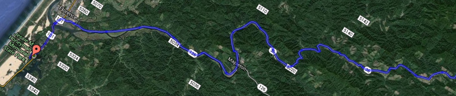
About a half mile past Vernonia, my google navigator steered me down a gravel road where I quickly came to a closed gate. There only signs posted was one prohibiting motor vehicles during certain hours, but from what I could tell, the gate should have been open at this time.

image

After a little contemplation, and checking the map, it seemed to me that I should follow googles direction and jump the fence. This side road seemed to parallel the highway to some extent anyway, and I thought it would be a nice diversion. So I unloaded my bike and lifted it over the gate.

image

According to the navigator, I had about 4.5 miles on this back road. And it was absolutely awesome. I’m so glad that I decided to jump the gate. The shot above was of a nice secluded break from the ride. Of course I had to circumvent a second gate when I reached the other side.

Once safely back on the pavement, I realized I was getting low on water, and was starting to look for some place to fill up. Unfortunately it wasn’t too long before I started climbing a serious hill (1,300 elevation). It was pretty hot, and there was nowhere to stop to refill. The only reason I had any water left at the top was because I was purposely conserving it. I was so thirsty at what I thought was the top, that I finished my last swallow.

image

I was looking at the navigator that indicated a left turn in about 3 to 4 miles. I was hoping that would be a turn into a service area with water. But much to my dismay, it was a turn onto another gravel road. Google was suggesting a shorter path to reach my destination (the ferry). It was overall a couple miles shorter. Man I was so thirsty. The heat and the ride really dried me up. I was thinking if I could shave a couple miles off, maybe I would get water that much quicker. And as I looked up the gravel road, I noticed a gate that was actually “open”. We that settles it for me. It was an open gate. Totally taking the shortest path.

As I turn onto another gravel road, the navigator chimes in that I should stay on this gravel road for another 4 miles. Ugh. Not at all what I wanted hear. My throat lets out a little groan. But at least I can handle this gravel okay.

When I each the other side where the navigator is telling me turn, I note with disappointment that the gate on this end of the road is actually closed. I’m thinking, this can’t be a good sign. That makes gate #3 that I’ve had to pass.

image

About a quarter mile past the other side, I come to this nearly empty logging lot. It stretches out like three or four football fields together in a square. And google is telling me to follow some imaginary road right through the middle of the thing. This is obviously private property at this point, and I’m thoroughly confused and disoriented. So I back track about a quarter mile, then return and wander aimlessly around the lot trying to find another road. Finally, after reaching the far side and tracing the border, I come to the gate pictured below. It was seriously hard to find.

image

Google chimes in again, “turn left”. So, this makes gate #4 that I’ve had to circumvent. By this time, I’m so numb to it all that I just lay my bike down and drag it under the gate. No sense in offloading any of my gear for this one.

More gravel. 🙁 I swallow, trying to wet my throat. How long has it been since I ran out of water? 10 miles? 12 miles? 2 hours? I dunno, but its been too long. About a half mile to three quarters of mile, I come to this lovely thing.

image

This time, it actually mentions “no trespassing” and the word prosecute. Now all the gates previous to this never said anything about no trespassing. So this is definitely a new level of disobedience if I decide to cross this gate. So I whip out the map and look at all the options. At this point, I’m looking at back tracking several miles to get out of this pickle. Or, just continue on as google is directing me and water will be in my path soon. Incidentally, I find it odd that there wasn’t a single stream back on the last 4 mile stretch of gravel. There should have been something, right?

So, this makes gate #5 that I’ve jumped (or ducked under in this case). Again I just lay the thing down and drag it under the gate.

After about a mile more of gravel road, I come to a T, which google doesn’t show on the map. So I guess that I should keep going forward as the route seems to indicate.

And now, this is where it gets really interesting. Even more so than all the other gravel roads. Suddenly I’m in a place that reminds me of hiking in Pico Canyon down in Santa Clarita (Southern California). I’m remembering these hiking trails where I had once fantasized about mountain biking down that path in Pico Canyon. Never once when I had that fantasy did I envision being on a fully loaded road bike with modest tires and no shocks. It was always with fat tires, and a cycle that could really handle the terrain. And that’s when it occurred to me that maybe Google thought I was riding a mountain bike. My mind flashed back to that NPR show where they were talking about the problem where google doesn’t consider your vehicle type, and this resulted in several large RVs getting stuck in places they shouldn’t be. Yes, that’s exactly what’s going on here. Just look at that crazy trail it sent me down.

image

Just before this shot, my phone app “Awoken” alerted me, reminding me to check my reality to see if I was actually dreaming. I got a real chuckle out of that. Oh, if I was dreaming I’d have a bottle of water in my hands right now. And just to be sure I wasn’t dreaming, I summoned my special powers to make a full water bottle appear. Nothing happened. I was not dreaming.

Shortly after this shot, I approached a curve in the path, and google chimed in to take a left. Seriously? Take a left on this, the only possible way the path can go?

Finally, gate #6 stands before me. And on the other side? Pavement. And a hundred yards down, a house with a running sprinkler to ride my bike through. I’m tempted to go up and start drinking from the thing.

A couple more houses down there’s these 3 guys grilling on their front porch, and one of them says “hey! How ya doing?”. I respond simply with “doing good”. Which is a total lie. I’m seriously dehydrated at this point, so I only get about 100 feet before I turn around a ride back up to their house.

The second guy is like “hey! You want some fried zucchini?”. It was actually a little tempting, but I passed and just asked if they could please help me out with some water. And the first guy was like ” yeah, come on over here and I’ll set you up”.

And let me tell you, this was no standard water hose he directed me too. This thing was on a tripod, and had a drinking fountain attached to it. For all I could see, the thing looked like it was made of gold shining in the sunlight. The second guy once again offered me some fried zucchini. He was really making a good pitch for it. And I kind of wish I had taken him up on the offer. I mean, how often does a complete stranger offer you fried zucchini fresh off their grill?

Well, that’s about all I’ve got time for today. That was a pretty long post, and I’m heading off to sleep now. I’ve got some decent video I hope to soon.

Posted in Pictures, Routes | 1 Comment

Day 1 – Epic Solo Bike Ride

Only at mile 4.25 and I’ve already finished an entire bottle of water.  This is unusual under normal circumstances, but it’s already really hot at 11:15, and the climb up River View cemetery was rough with the 50 pounds I’m carrying (I hear Maria Schur saying “too much weight”).  Refilled water at KFC and dropped in a Nuun.  I suspect I will run short on that stuff as I only brought 12, and used 3 on the first day.

image

image

First stop to eat is a L&L Hawaiian BBQ at the mall in Beaverton.  Only at mile 12, and I was hungry.  Actually, I was hungry again the moment I finished eating here, so I stopped again in Hillsboro Subway at mile 21.  And then I was hungry again after that.  I was pretty much hungry all day today.   So much for the new motto of eating before you’re hungry.

As I pulled up to Subway, there was a loud Harley Davidson revving its engine just before a horrible skid followed by metal scraping the ground, and the Harley motor was silenced.  Followed by a single male voice yelling “OOOOOOH!”.  No serious injuries, but the bike was unfortunately too damaged to drive away.

Had a brief conversation with another cyclist who had rode across the US twice.  And while I didn’t understand all the technical jargon about tire and frame sizes, one comment he made did stand out to me. “So… You’ve only got two water bottles then?”.  And there was emphasis on the *only* and *two*.  And considering how much water I’ve gone through today, his words followed me through the day.  I will need to buy water bottles on day 6 when I head out on the Pacific Northwest Trailhead.

image

I arrived in Banks at about 4:30, a bit later than I had hoped.  And I tried standing behind this post to get a tiny bit of shade from the scorching heat. It is only here that I realized just how hot it had been today.  I think I was thrown off by the strong headwind that I had been fighting against all the way from Hillsboro to Banks.

image

So thankful for the Banks Vernonia trail.   Where there was shade, protection from the headwind, and blackberries all in the same stretch.  Nom Nom.

image

Banks Vernonia trail.

image

As I stood here marveling at my accomplishment of reaching Stub Stewart park, I had to quickly jump on my bike and escape a yellow jacket who was ignoring my swiping hand and trying to help himself to the now open wound on my knee (they eat meat you know.  And I suspect they like fresh human blood too, judging from this one’s behavior.)

image

As I arrive, I find people camped in the site I thought I had reserved.  But apparently I had mixed up in my head the reservations from my June trip with this trip.  And apparently I had mixed them up so badly, that I just hadn’t reserved a campsite AT ALL for this trip.  Epic failure on my part.  I was thinking to myself that I’d never let this organization plan my biking trips again!  Oh wait, I’m talking about myself here.   Sigh.

Long story short, I had to hike an extra 2 miles and spend an extra hour and half sorting out the mess and moving all my stuff from one site to another.  By the time I was finished with moving and showering, it was after 8:30 pm.  All my spare fun rest time for the evening was all used up.

For a brief while, I was really satisfied with my decision in Banks to buy food that required little or no cooking.  I had figured I was going to be really tired.  And the campsite cock-up just made me more tired and not wanting to cook.  So I ate my beef and bean burritos before showering, and then after showering, sat down to heat the water for the cup of noodles that only required hot water to be added.

Not sure why I thought it was a good idea to hold the cup of noodles in my left hand while pouring the boiling water into the cup.  But it was the dumbest mistake of the day.  I spent the next couple hours trying to feed my hungry belly with one hand sitting in a pool of water that had accumulated below the water spigot at the campgrounds.

image

Oh, that water was soothing!

No burn medicine in my first aid kit.  🙁  so I had a Vicodin to try and help me sleep with the burning pain.

All in all?  It was still a great and beautiful ride.  Waking now for day two, and feeling good.  Though I’m nervous about heating water for my oatmeal.  😉

image

Link to the GPS map of the ride can be found here – epic solo bike ride partmap – day 1.

Posted in Pictures, Routes | 3 Comments

Itinerary for epic solo bike ride

I can’t get Google maps to place the route precisely the way I want with an embedded map, and it won’t do it on a single map.  So I’ve created a couple of links to the tentative route and will simply have to list my destinations until I can get my Android app to record the journey.

First Map is here.
Second Map is here.

The tentative and flexible plan.

Day 1 (8/1) : From Host Pond to L.L. Stub Stewart State Park
Day 2 (8/2) : From L.L. Stub Steward State Park to Skamokawa Vista Park
Day 3 (8/3) : From Skamokawa Vista Park to Bruceport Park
Day 4 (8/4) : From Bruceport Park to Pacific Beach State Park
Day 5 (8/5) : From Pacific Beach State Park to Kalalock Campground
Day 6 (8/6) : From Kalalock Campground to Strawberry Point (or Bay)
                     Possible swim across Hoh River, instead of road to bridge.
                     Happy Birthday to me, by the way.
Day 7 (8/7) : From Strawberry Point to West side of Ozette Lake
Day 8 (8/8) : West side of Ozzette Lake somewhere (Tskawahyah Island?)
Day 9 (8/9) : Hobuck Beach Resort
Day 10 (8/10) : Pickup somewhere, or ride into Seattle

 Pacific Northwest Trail - Epic Bike Route

Posted in Routes | 2 Comments