Approximate 42 mile ride around Moorea island. Moorea is an island, just a few short miles west of Tahiti. It’s one of the best bicycle rides I’ve *ever* had the opportunity to ride. Read below the map for further details about the ride, and how to prepare.
View Moorea (Tahiti) round trip + Belvedere in a larger map
The first thing to be aware of is that helmets are NOT required in Tahiti or Moorea. And for some reason, because they are not required NOBODY wears them, and none of the bike rental places even have them available for rent or purchase. If you feel uncomfortable riding without a helmet, be sure to pack one in your suit case.
 bicycle ride 2012") I estimate that there are bike lanes on at least 1/3 of the road that runs around the entire outer edge of the island.
I estimate that there are bike lanes on at least 1/3 of the road that runs around the entire outer edge of the island.
I personally felt very safe even when there were no bike lanes. Most of the drivers on the island are very considerate of the bicyclists and give plenty of room. They do not try and pass when there are on coming cars.
We rented our bikes directly from the Hotel Intercontinental which is near the north west corner of the island. These mountain bikes were all in very good shape and handled the trip well. Ok, maybe not all of them. One of the three bikes we rented was making some clicking sounds, and eventually, near the top of Belvedere, the gears started slipping. I suppose we could have called the hotel for support, but my fellow rider Michael was determined to complete the ride, and he did finish without interruption. There were also a couple of bike rental places just west of the Hotel Intercontinental. While those bikes looked okay, I did not think they were as good as the bikes to choose from at the hotel.
Bike rental costs at the hotel were 1,300 CFP’s (about $13 USD) for 4 hours, or 1,600C CFP’s (about $16 USD) for the entire day. They were pretty adamant about having the bikes back before sunset, or about 5:30pm at this time of year. According to the hotel, if you had bike trouble, like a flat, you can call the hotel and they would come pick you up, or come and repair the flat tire.
 Belvedere side road") Near the end of our ride around the island, we decided to take the back road way up to Belvedere lookout.
Near the end of our ride around the island, we decided to take the back road way up to Belvedere lookout.
What we didn’t realize is that the stretch of road marked in RED on the map to the left was dirt and gravel. Thankfully our rented mountain bikes were plenty capable of trekking up this road. But please note that you do not need to ride the dirt/gravel section at all. You can take the paved road the entire way around the outer edge of the island. There is also paved road all the way to Belvedere lookout.
The reason the track of the map is not complete around the entire island is simply because the battery in my smart phone died about half way up to the top of Belvedere lookout.
 dirt road to Belvedere")
") Here is the view from Belvedere lookout. I believe this is one of the highest locations you can get to by vehicle on the island. It’s a beautiful view of the two bays on the north end of the island.
Here is the view from Belvedere lookout. I believe this is one of the highest locations you can get to by vehicle on the island. It’s a beautiful view of the two bays on the north end of the island.
The ride to the top of Belvedere is approximately 6 kilometers from the bay. Well worth the climb in my opinion.
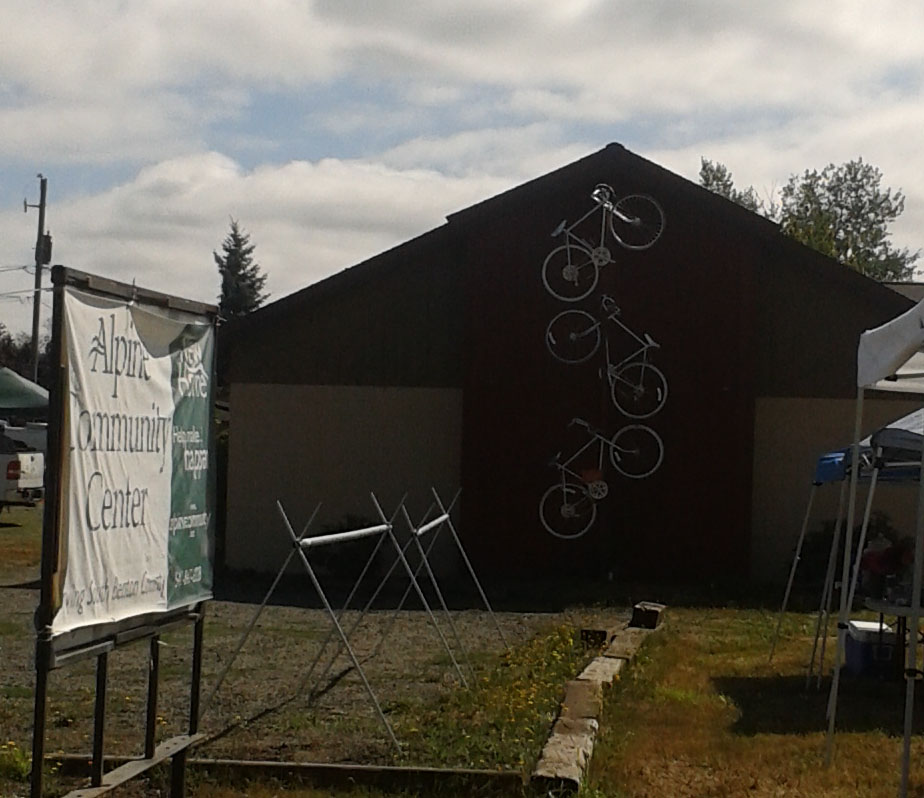 There was this bicycle artwork at the Alpine Community Center where we stopped off to sunscreen up. Stopped and chatted with one of the support crew from another local ride. He recommended visiting a closeby waterfall, but we opted to not add another 20 to 30 miles to our ride for the day.
 My phone/camera memory card crapped out on me this evening. And it appears that me taking this picture of a dead possum is the corrupt image that killed it. Thankfully I took two pictures, so I actually preserved one pic of it. Too bad I couldn’t get the Vulture on camera that was eating on it before we pulled up.
 Map is for Facebook to grab as the icon.
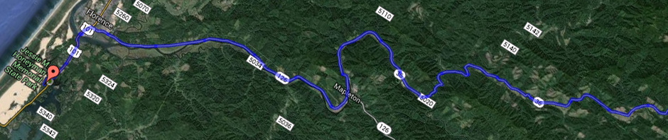
